A terrier is a written record of a landholding in the open fields. It will proceed land (strip) by land, describing the location of each by field and furlong, and by the occupiers of the lands on each side. The most common terriers describe the land owned by the church, and are known as glebe terriers. Other terriers describe the land of a single landowner, or sometimes all the landowners in a parish.
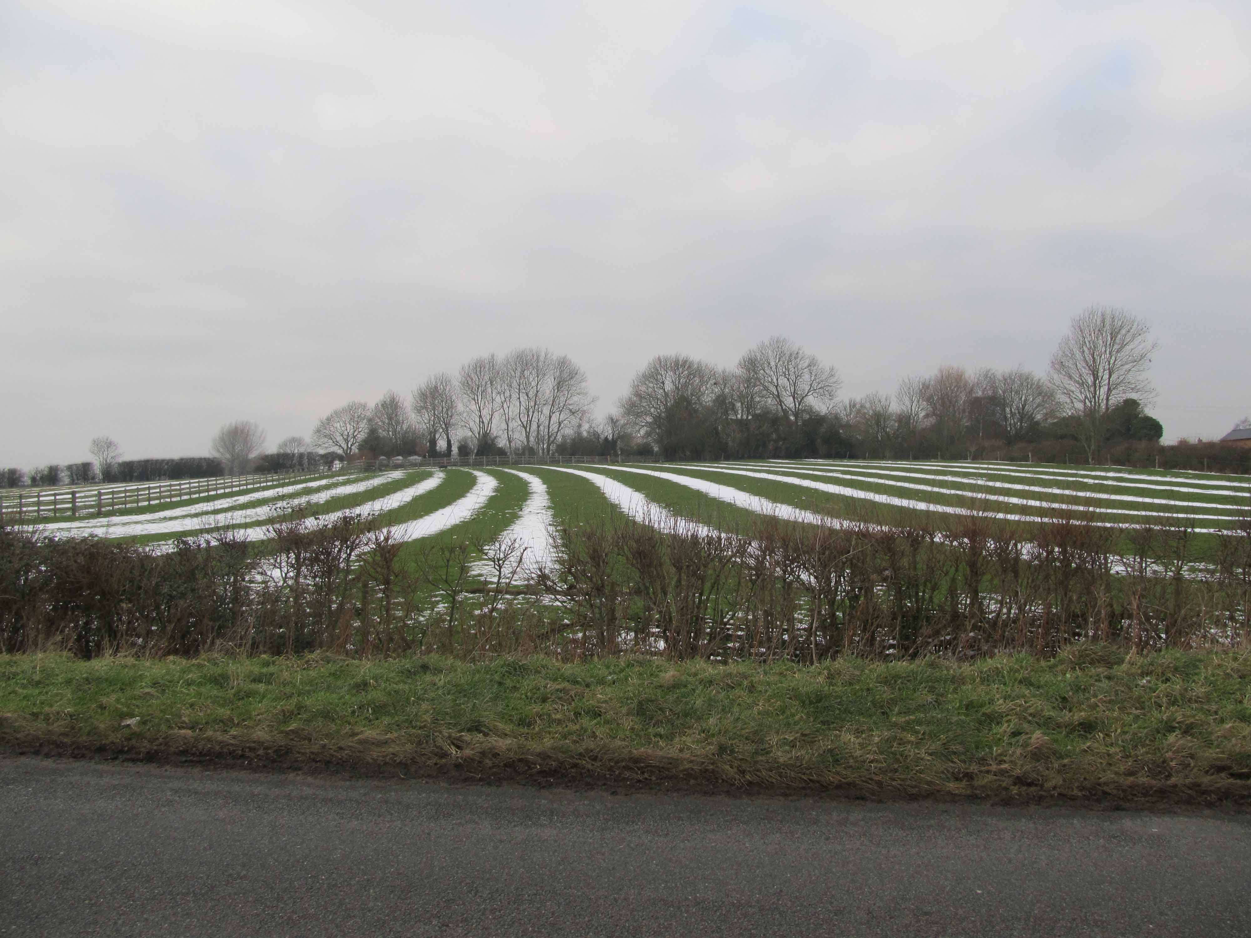
The way that the lands and furlongs were laid out can sometimes still be seen in the ridge and furrow that underlies much of the permanent pasture in the heavy soils in the south and east of the county, or in old aerial photographs of the land.
The reverse-S shape of medieval ridge and furrow at Leire highlighted by a snowfall
Surveys provide an accurate measurement of the land being described. They were usually compiled for individuals, for example when land was sold or provided as a marriage portion. Major landowners might also have a survey book, perhaps accompanying an estate map, listing the size of each parcel of their land, its use and, if rented, the name of the occupier. The total quantity of the land may be given in yardlands, which varied in size from parish to parish.
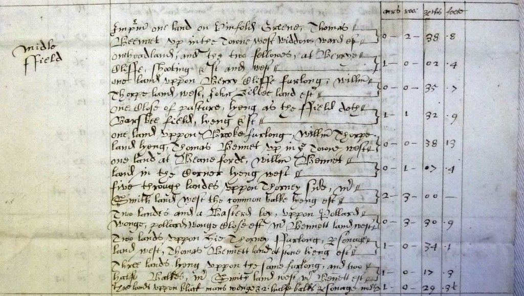
A survey of the land held by widow Skinner in Middle Field, Queniborough in 1640. Courtesy of The Record Office for Leicestershire, Leicester and Rutland, 35'29/415
A survey of widow Skinner’s land in Queniborough in 1640, for example, tells us that she owned 2½ yardlands scattered in individual strips across five open fields: Middle Field, Hayhill Field, Ashe Field, Great Sand Field and Little Sand Field. She also owned some meadow. Her total landholding comprised:
38.5 acres of arable land (including fallow) plus
13 acres of leys (grass strips) in the open fields, plus a
1 acre close adjacent to her house, plus
5.75 acres meadow
58.25 acres
This tells us that a yardland in Queniborough contained 23 acres.